Legislative Services
Integrated redistricting technology, data, and consulting.
Complete solutions for the redistricting process
Citygate GIS supports legislative redistricting from initial Census data preparation through district design, analysis, public participation, and final plan publication. Our software and consulting services bring together the data, tools, and expertise needed to manage complex redistricting projects.
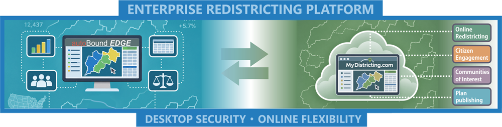
With autoBound EDGE desktop redistricting software and MyDistricting.com, Citygate connects professional map development with online redistricting, public review, and community engagement—creating a coordinated platform for the full redistricting process.
One integrated redistricting platform
Your Plans. Your Control. autoBound EDGE supports desktop-first redistricting, allowing legislators and staff to develop, analyze, and refine plans without requiring those plans to be stored online. Users choose when to share their work: plans can remain on their local systems until they are ready for optional online redistricting, plan publishing, public commenting, and communities-of-interest engagement through MyDistricting.com.
Technology and services for every phase
Census Data Support
Support for Census redistricting data programs and Phase 1, Phase 2, and Phase 3 data preparation, processing, and delivery.
Election Data & Demographic Analysis
Process and integrate election data; analyze population, demographic characteristics, and geographic patterns for district planning.
Desktop & Online Redistricting
Design and evaluate districts in autoBound EDGE desktop software and provide online redistricting through MyDistricting.com.
Plan Publishing & Commenting
Publish proposed redistricting plans online, present accessible maps, and collect structured public comments on plan alternatives.
Community Engagement & Communities of Interest
Support community participation and capture, map, and review communities of interest as part of the redistricting process.
Redistricting Consulting & District Analysis
Provide redistricting consulting, prisoner population adjustments, compactness analysis, geographic mapping, and technical evaluation of plans.
Have a complex planning challenge?
Explore how Citygate's geospatial expertise and technology can support your next project.
Contact Citygate →