- Client:
- Elections Canada
- Project:
- Commission Redistricting tool for Elections Canada
- Duration:
- 1 Year
- Project Cost:
- $200,000
- Software:
- ESRI ArcView
- Distribution:
- FED Judges Throughout Canada
Project Description:
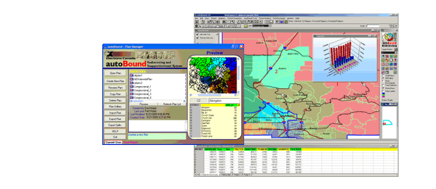
This project involved the customization of the Citygate’s AutoBound Redistricting and Reapportionment System for use in redistricting of FED boundaries in Country of Canada. The redistricting of FED boundaries in Canada is performed by a panel of Federal Judges. The following is an overview of the enhancements and customizations made to the product.
1. Use of Canadian Data. The standard version of autoBound was designed to work with the US Census Brueau’s TIGER and PL data. The product was modified for use with data provided by Election’s Canada and Statistics Canada.
2. Field Editing of GIS base data. The geographic files provided by Statistics Canada were not as detailed as ones used in US by the Census Bureau. As such, the need arose for the Canadian users of the system to be able to split and draw new blocks in the field, in order to complete certain redistricting functions. The new block boundaries were then compressed into update files and sent via FTP to Elections Canada for further processing and updating a central system. The functionality necessary for the block splitting process as well as the communication of the updates to the central system was developed by Digital Engineering as a part of the Commission Redistricting System.
3. Development of a French Version. Canadian law also required the development of a French version of the autoBound product. As such, Citygate used a French version of Arcview GIS and modified autoBound to include a French user interface, menus, reports, training material and documentation.