- Client:
- Maryland State Highway Administration
- Project:
- Enterprise GIS Development
- Duration:
- 2 Years
- Project Cost:
- $1,100,000
- Software:
- ESRI ArcView
- Distribution:
- 400 Engineers throughout the Maryland State Highway Administration
Project Description:
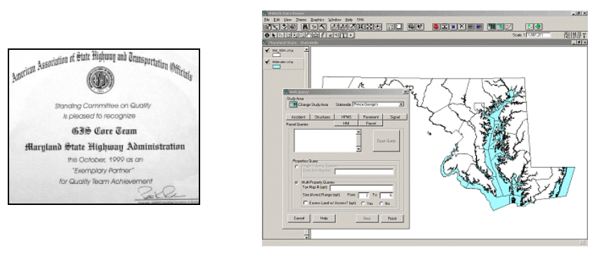
Worked with ESRI and MDSHA staff to develop a comprehensive ArcView based GIS application used for management of Maryland Interstate and State Highways. The Goal of the project was to develop a mapping tool designed to disseminate existing databases for use by engineers throughout the State Highway Administration.
The first phase of the project included a comprehensive needs analysis based on user interview and system analysis. Two-person teams conducted over 30 interviews with various SHA personnel. The next phase of the project focused on the development of an application prototype, which would satisfy the requirements outlined in the needs assessment.
Ultimately, a wizard-based application was developed to allow district engineers to quickly and easily perform complex database queries, create maps and produce reports. The software also included tools for automatic update of remote databases. The completed product recently underwent rollout to over 200 engineers throughout the MDSHA offices. The project was extended to provide further customization for key offices within the MDSHA.
This project was the winner of the 1999 American Association of State Highway and Transportation Officials (AASHTO) “Exemplary Partner” Award. This award is one three given nationally for exceptional achievements in transportation technology.